 Paikkatietohakemisto
Administrative boundaries
Type of resources
Topics
Keywords
Contact for the resource
Provided by
Formats
Representation types
Update frequencies
Scale
-

Division into administrative areas (raster) is a dataset depicting the municipal Division of Finland. The dataset Municipal Division is produced in scales 1:10,000, 1:100,000, 1:250,000, 1:1,000,000 and 1:4,500,000. The data included in the dataset in scale 1:10,000 are taken from the Cadastre. Regarding other scales, municipal boundaries have been generalised to suit the scale in question. Division into administrative areas products in raster format include municipal boundaries only. The product is a part of the open data of the National Land Survey.
-

Division into administrative areas (vector) is a dataset depicting the municipalities, regions, Regional State Administrative Agencies, and the national border of Finland. The Division into administrative areas products in vector format contain the number codes of the municipalities, the names of the municipalities in both Finnish and Swedish as well as municipal boundaries and municipal geographical areas. In addition, the products include the corresponding information about the regions, the Regional State Administrative Agencies, and the nation as well as a specification of the municipality's area into land and water area. The municipality's area is not included in the XML/GML and GeoPackage format. The dataset Municipal Division is produced in scales 1:10,000, 1:100,000, 1:250,000, 1:1,000,000 and 1:4,500,000. The data included in the dataset in scale 1:10,000 are taken from the Cadastre. Regarding other scales, municipal boundaries have been generalised to suit the scale in question. The product is a part of the open data of the National Land Survey.
-
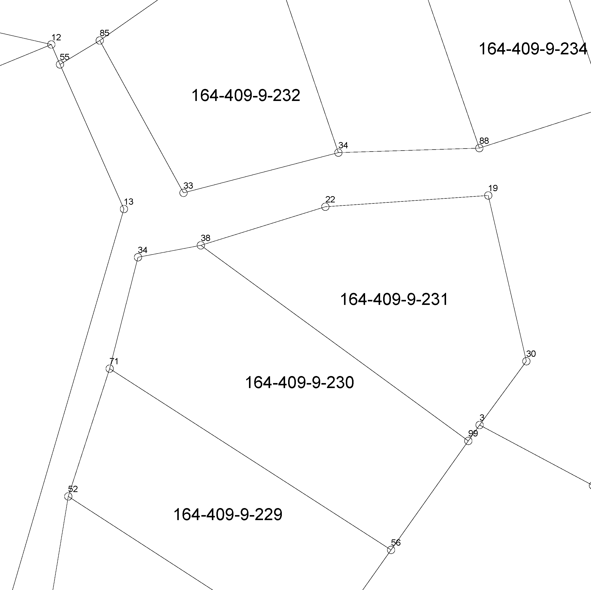
The location of the real property unit is shown on the cadastral index map. On the map, there are property and other register unit boundaries and property identifiers. The product is a part of the open data of the National Land Survey. Further information (in Finnish): http://www.maanmittauslaitos.fi/kiinteistot/asiantuntevalle-kayttajalle/kiinteistotiedot-ja-niiden-hankinta
-

The location of the real property unit is shown on the cadastral index map. On the map, there are property and other register unit boundaries, boundary markers and property identifiers. The product is a part of the open data of the National Land Survey. Other attribute data related to properties are available in the Cadastre. Further information (in Finnish): http://www.maanmittauslaitos.fi/kiinteistot/asiantuntevalle-kayttajalle/kiinteistotiedot-ja-niiden-hankinta
-

The Topographic database is a dataset depicting the terrain of all of Finland. The key objects in the Topographic database are the road network, buildings and constructions, administrative borders, geographic names, land use, waterways and elevation. Aerial photographs, scanning data and data provided by other data providers are utilised in updating the Topographic database. The updating is done in close cooperation with the municipalities. Field checks in the terrain are also needed to some extent, mostly as regards the classification of features. The topographic database is used in the production of other map products and in various optimisation tasks. The product belongs to the open data of the National Land Survey of Finland.